Measurement Tool
The measurement tool is used to calculate distances between 2 or more user-defined points on the map.
Steps For Measuring Length
- Click the measure by line tool
 on the Tools toolbar.
- Move the mouse over the map to the starting position.
- Using the left mouse button click once and now move to the next position. A line will draw as the mouse is moved.
- Using the left mouse button click once to define the end position.
- Repeat steps 3 and 4 to create a multi point line as necessary.
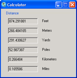
- Complete the measurement by double clicking instead of single clicking for the final point with the left mouse button. The distance will be calculate and displayed.
Example length measurement:

Steps For Measuring Area
- Click the measure tool
 on the Tools toolbar.
- Move the mouse over the map to the starting position.
- Using the left mouse button click once and now move to the next position. A line will draw as the mouse is moved.
- Using the left mouse button click once to define the end position.
- Repeat steps 3 and 4 to create the necessary polygon.
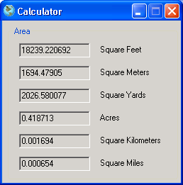
- Complete the measurement by double clicking instead of single clicking for the final point with the left mouse button. The area will be calculate and displayed.
Example area measurement:
